Showing posts with label JPL. Show all posts

Monday, May 7, 2018

JPL News - Day in Review

DAY IN REVIEW
NASA Highlights Science on Next Orbital ATK Mission to Space Station
NASA will host a May 10 media telecon about select science investigations and tech demonstrations on the next Orbital ATK commercial flight to the International Space Station.
› Read the full story
NASA Satellite detects Kilauea Fissures
The eruption of Kilauea Volcano on the island of Hawaii triggered a number of gas- and lava-oozing fissures in the East Riff Zone of the volcano.
› Read the full story


Saturday, May 5, 2018

JPL News - Day in Review

DAY IN REVIEW
NASA, ULA Launch Mission to Study How Mars Was Made
NASA's Mars InSight mission launched this morning on a 300-million-mile trip to Mars to study for the first time what lies deep beneath the surface of the Red Planet.
› Read the full story
NASA's First Deep-Space CubeSats Say: 'Polo!'
MarCO is a pair of tiny spacecraft that launched with NASA's InSight lander today.
› Read the full story


Thursday, May 3, 2018

JPL News - Day in Review

DAY IN REVIEW
NASA JPL latest news release
NASA's First Mission to Study the Interior of Mars Awaits May 5 Launch
All systems are go for NASA's next launch to the Red Planet.
The early-morning liftoff on Saturday of the Mars InSight lander will mark the first time in history an interplanetary launch will originate from the West Coast. InSight will launch from the U.S. Air Force Vandenberg Air Force Base Space Launch Complex 3E. The two-hour launch window will open on May 5 at 4:05 a.m. PDT (7:05 a.m. EDT).
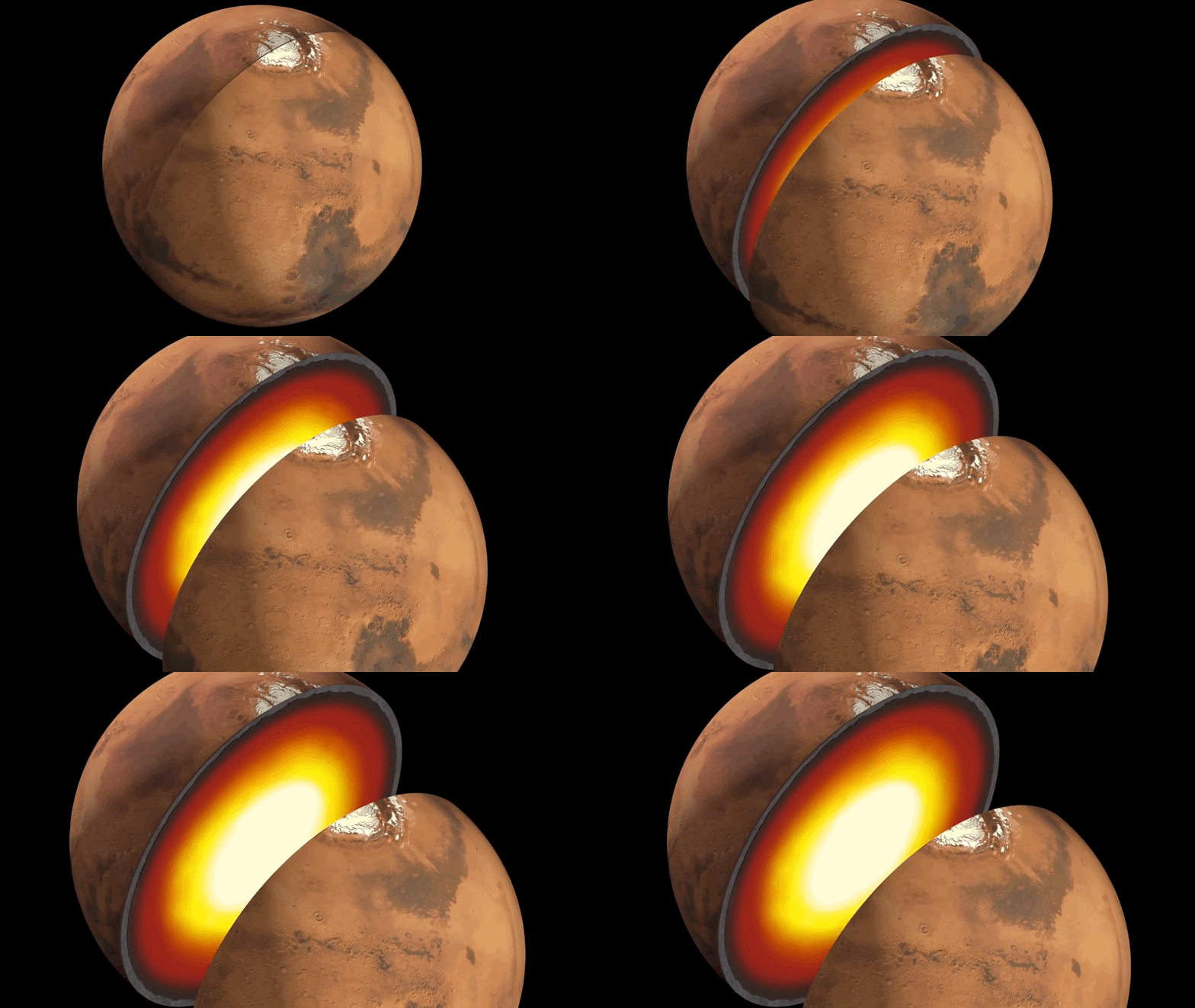
InSight, for Interior Exploration using Seismic Investigations, Geodesy and Heat Transport, will launch aboard aUnited Launch Alliance (ULA) Atlas V rocket. InSight will study the deep interior of Mars to learn how all rocky planets formed, including Earth and its Moon. The lander's instruments include a seismometer to detect marsquakes, and a probe that will monitor the flow of heat from the planet's interior.
The ULA rocket will carry the spacecraft over the Channel Islands just off the California Coast and continue climbing out over the Pacific, shadowing the coastline south beyond Baja California. InSight's Atlas will reach orbit about 13 minutes after launch, when the rocket is about 1,200 miles (1,900 kilometers) northwest of Isabella Island, Ecuador.
"For those Southern Californians who are interested in rockets or space exploration, or have insomnia, we hope to put on a great show this Saturday," said Tom Hoffman, InSight project manager from NASA's Jet Propulsion Laboratory in Pasadena, California. "But for those who want to sleep in on Saturday, there will be another opportunity to engage with this historic mission. We will be landing on Mars in the western Elysium Planitia region on Monday, Nov. 26, around noon Pacific time. You will be able to watch a live stream of this landing while working on your holiday shopping."
Getting a Mars mission flying requires a great many milestones. Among those still to come are the official start of the countdown to launch -- which comes on Friday, May 4 at 10:14 a.m. PDT (Saturday, May 5, 1:14 a.m. EDT). A little over an hour later, at about 11:30 p.m. PDT (May 5, 2:30 a.m. EDT), the 260-foot-tall (80-meter) Mobile Service Tower -- a structure that has been protecting the Atlas V launch vehicle and its InSight payload during their vertical assembly -- will begin a 20-minute long, 250-foot (about 80-meter) roll away from the Atlas. Four hours and 25 minutes later, the launch window will open.
"I've been to several rocket launches, but it is a whole different vibe when there is something you've been working on for years sitting in the nose cone waiting to get hurled beyond our atmosphere," said Bruce Banerdt, InSight principal investigator at JPL. "But as exciting as launch day will be, it's just a first step in a journey that should tell us not only why Mars formed the way it did, but how planets take shape in general."
InSight's launch period is May 5 through June 8, 2018, with multiple launch opportunities over windows of approximately two hours each date. Launch opportunities are set five minutes apart during each date's window.Whichever date the launch occurs, InSight's landing on Mars is planned for Nov. 26, 2018, around noon PST (3 p.m. EST).
JPL manages InSight for NASA's Science Mission Directorate. InSight is part of NASA's Discovery Program, managed by the agency's Marshall Space Flight Center in Huntsville, Alabama. The InSight spacecraft, including cruise stage and lander, was built and tested by Lockheed Martin Space in Denver. NASA's Launch Services Program at the agency's Kennedy Space Center in Florida provides launch management. United Launch Alliance of Centennial, Colorado, is NASA's launch service provider of the Atlas 5 rocket. A number of European partners, including France's Centre National d'Études Spatiales (CNES) and the German Aerospace Center (DLR), are supporting the InSight mission.In particular, CNES provided the Seismic Experiment for Interior Structure (SEIS) instrument, with significant contributions from the Max Planck Institute for Solar Systems Research (MPS). DLR provided the Heat Flow and Physical Properties Package (HP3) instrument.
For more information about InSight, visit:
https://mars.nasa.gov/insight/
Live televised coverage of the launch will be available at:
https://www.nasa.gov/live
For information on viewing the launch in person, visit:
https://mars.nasa.gov/insight/mission/timeline/launch/watch-in-person/

Fri & Sat: A NASA/JPL Edu Teachable Moment Twofer

NASA/JPL Edu Teachable Moments
 

This Week's Teachable Moment Twofer

The next couple days are full of opportunities to turn space exploration events into teachable moments for students. Make it happen with these resources and activities from the Education Office at NASA's Jet Propulsion Laboratory.

First up is Star Wars Day on Friday, May 4. (Or as fans like to say, "May the fourth be with you.") While the movies are science fiction, they do feature some very real technology that's been used to propel NASA spacecraft to other worlds – and it makes for a great high-school lesson in Newton's Laws. It's also the perfect time to awaken students in all grades to lessons in forces and motion. Explore the links below to get started.

  • Teachable Moment: Here's how to turn a Star Wars staple into a real-world lesson in Newton's Laws.
  • May the Fourth Lessons: Celebrate Star Wars Day with these standards-aligned lessons in motion and forces for grades K-12.

After learning about forces on May the 4th, students might be able to see them in action the very next day! NASA's next mission to Mars is scheduled to launch as early as 4:05 a.m. on May 5. The Central California liftoff means that viewers across much of the state will likely be able to see the launch from home, but people elsewhere or those with obscured views can also watch it on NASA TV. In addition to the launch, the mission itself, which is designed to reveal Mars' inner workings and provide a window into how other rocky planets formed, offers a host of real-world STEM learning opportunities. Find out more at the links below.

  • Teachable Moment: What is NASA InSight and what can it teach students about STEM?
  • Mars Lessons: Explore a collection of standards-aligned lessons for K-12 all about the Red Planet.

 NASA's Jet Propulsion Laboratory

4800 Oak Grove Dr

Pasadena, CA 91109

Wednesday, May 2, 2018

JPL News - Day in Review

DAY IN REVIEW
NASA JPL latest news release
GRACE-FO: Cracking a Cold Case

Mission To Study How Melting Polar Ice Affects Regional Sea Levels

Reports of the rapidly melting West Antarctic ice sheet often refer to how much the melting could add to global sea levels -- as if meltwater raises the ocean evenly, like a sink filling up. The reality is far different. Water from West Antarctica will end up raising sea levels more in Los Angeles and Miami than in Rio de Janeiro, for example, even though Brazil is thousands of miles closer to Antarctica than the United States.

How do we know? Scientists first observed this ocean pattern using data from NASA's Gravity Recovery and Climate Experiment (GRACE) satellite mission, which ended last October after 15 years of operation. When the NASA/German Research Centre for Geosciences GRACE Follow-On (GRACE-FO) mission is launched from Vandenberg Air Force Base in Central California next month, it will take up the job of monitoring melting polar ice. That will give scientists a renewed opportunity to understand some of the many processes that lead to different rates of sea level rise on different coastlines. Since runoff from melting ice sheets and glaciers currently accounts for about two-thirds of global sea level rise, understanding these melt-related processes is a critical piece of understanding sea level change at a regional scale.

Fingerprints of Water

The gravitational pull of an ice sheet attracts seawater from the nearby oceans and causes it to pile up along the coastlines. When the ice sheet melts and loses mass, the gravitational pull is reduced, causing the sea level nearby to fall. At the same time, the additional meltwater in the ocean causes sea level rise -- but it rises farther away from the melt source. The falling sea level near the ice sheet and rising sea level farther away are connected like the rising and falling ends of a seesaw. Since every ice sheet and glacier has a unique location and size, each one creates a different seesawing pattern, as individual as a fingerprint.

Scientists had theorized that these fingerprint patterns existed, but only observationally detected them for the first time in September 2017 using GRACE data.

The fingerprints from Greenland and Antarctica reach across the equator, so that low- and mid-latitude land masses are affected by melting from both regions. These coastlines may be affected more strongly by the ice loss in the opposite hemisphere. New York City, for example, experiences slightly more sea level rise from ice melt in Antarctica than from Greenland. Or for an extreme example, Greenland's ice loss is currently estimated to contribute 12 times as much to sea level rise in Cape Town, South Africa, than it is to rising seas in London, even though London is 8,000 miles closer to Greenland.

How GRACE-FO Works

GRACE-FO, like GRACE, is designed to measure monthly changes in gravitational pull that result from changes in the mass on Earth below the orbiting satellites. More than 99 percent of Earth's mean gravitational pull does not change from one month to the next, because it is due to the solid Earth itself -- its surface and interior. Water, however, moves continuously nearly everywhere: rain falls, ocean currents flow, ice melts and so on. As the twin GRACE-FO satellites orbit Earth, one closely following the other, these moving masses alter the gravitational pull below the two satellites, changing the distance between them very slightly. The record of these changes is analyzed to create monthly maps of the variations and redistribution of Earth's mass near the surface.

Imprints Below Earth's Surface

Another effect of the changing mass from melting ice involves not just recent ice loss but the continental-scale melt-off that ended about 6,000 years ago. That ancient event still has repercussions for sea levels on today's coastlines.

Frank Webb of NASA's Jet Propulsion Laboratory in Pasadena, California, the project scientist for GRACE-FO, used the analogy of memory foam to describe this effect. "When you lie on a memory foam bed, you sink into it. When you get up, it rebounds, slowly. There may be a slight bulge around where you were lying." In the same way, an ice sheet presses on Earth's viscous mantle layer, about 50 miles below the surface. Over millennia, the heavy ice pushes the surface layer down into the mantle, and mantle material bulges out elsewhere. When an ice sheet melts, the mantle flows back in the reverse direction, in a process that plays out for millennia after the ice has disappeared.

The North American tectonic plate is still rebounding from the loss of mass at the end of the last ice age. At that time, today's Canada and Greenland were buried beneath thick ice while most of what is now the United States remained ice free. The mantle flowed away from under Canada and bulged under the United States. Today, as the flow moves in the opposite direction, the U.S. side of the North American plate is sinking very slowly, and Canada is rising.

Even if there were no other changes occurring in today's oceans, these up-and-down movements of the solid Earth would cause sea levels to change on today's U.S. East Coast. As it is, they add to or counteract other influences on sea level.

The Bottom Line

Since the original GRACE mission launched in 2002, its measurements have shown that Greenland has been losing about 280 gigatons of ice per year on average, and Antarctic losses are at a rate of almost 120 gigatons per year. (One gigaton of water would fill about 400,000 Olympic-sized swimming pools.) The data also showed that the rate of loss accelerated from 2003 to 2013 by about 25 gigatons per year every year in Greenland, and 11 gigatons per year every year in Antarctica. While considerable uncertainties remain, the measurements from GRACE over the past 15 years leave scientists and planners concerned that sea level rise will be measured in feet rather than inches by the end of the century.

Combined, these other effects from gravitational changes as ice melts in Greenland and Antarctica can add or subtract 25 to 50 percent of a regional change in sea level caused by melting ice alone.

Questions remain about all of these processes. For example, how much natural variation is there in the rate of ice loss that we are currently observing? How does ice loss in some regions interact with natural climate patterns such as El Niño? While 15 years of high-quality, global and nearly uninterrupted data from GRACE have already produced a plethora of discoveries, the longer data record from GRACE-FO is essential to tease out the signal of long-term climate evolution from shorter-term effects of these recurring climate patterns.

GRACE-FO is scheduled to launch on May 19. For more information, see:

http://gracefo.jpl.nasa.gov/

https://www.nasa.gov/missions/grace-fo


Monday, April 30, 2018

JPL News - Day in Review

DAY IN REVIEW
NASA JPL latest news release
Twin Spacecraft to Weigh in on Earth's Changing Water

A pair of new spacecraft that will observe our planet's ever-changing water cycle, ice sheets and crust is in final preparations for a California launch no earlier than Saturday, May 19. The Gravity Recovery and Climate Experiment Follow-On (GRACE-FO) mission, a partnership between NASA and the German Research Centre for Geosciences (GFZ), will take over where the first GRACE mission left off when it completed its 15-year mission in 2017.

GRACE-FO will continue monitoring monthly changes in the distribution of mass within and among Earth's atmosphere, oceans, land and ice sheets, as well as within the solid Earth itself. These data will provide unique insights into Earth's changing climate, Earth system processes and even the impacts of some human activities, and will have far-reaching benefits to society, such as improving water resource management.

"Water is critical to every aspect of life on Earth -- for health, for agriculture, for maintaining our way of living," said Michael Watkins, GRACE-FO science lead and director of NASA's Jet Propulsion Laboratory in Pasadena, California. "You can't manage it well until you can measure it. GRACE-FO provides a unique way to measure water in many of its phases, allowing us to manage water resources more effectively."

Like GRACE, GRACE-FO will use an innovative technique to observe something that can't be seen directly from space. It uses the weight of water to measure its movement -- even water hidden far below Earth's surface. GRACE-FO will do this by very precisely measuring the changes in the shape of Earth's gravity field caused by the movement of massive amounts of water, ice and solid Earth.

"When water is underground, it's impossible to directly observe from space. There's no picture you can take or radar you can bounce off the surface to measure changes in that deep water," said Watkins. "But it has mass, and GRACE-FO is almost the only way we have of observing it on large scales. Similarly, tracking changes in the total mass of the polar ice sheets is also very difficult, but GRACE-FO essentially puts a 'scale' under them to track their changes over time."

A Legacy of Discoveries

GRACE-FO will extend the GRACE data record an additional five years and expand its legacy of scientific achievements. GRACE chronicled the ongoing loss of mass from the Greenland and Antarctic ice sheets and mountain glaciers. That wealth of data shed light on the key processes, short-term variability and long-term trends that impact sea level rise, helping to improve sea level projections. The estimates of total water storage on land derived from GRACE data, from groundwater changes in deep aquifers to changes in soil moisture and surface water, are giving water managers new tools to measure the impact of droughts and monitor and forecast floods.

GRACE data also have been used to infer changes in deep ocean currents, a driving force in Earth's climate. Its atmospheric temperature profile data, derived from measurements of how signals from the constellation of GPS satellites were bent as they traveled through the atmosphere and received by antennas on the GRACE satellites, have contributed to U.S. and European weather forecast products. GRACE data have even been used to measure changes within the solid Earth itself, including the response of Earth's crust to the retreat of glaciers since the last Ice Age, and the impact of large earthquakes.

According to Frank Webb, GRACE-FO project scientist at JPL, the new mission will provide invaluable observations of long-term climate-related mass changes.

"The only way to know for sure whether observed multi-year trends represent long-term changes in mass balance is to extend the length of the observations," Webb said.

An Orbiting Cat and Mouse

Like its predecessors, the two identical GRACE-FO satellites will function as a single instrument. The satellites orbit Earth about 137 miles (220 kilometers) apart, at an initial altitude of about 305 miles (490 kilometers). Each satellite continually sends microwave signals to the other to accurately measure changes in the distance between them. As they fly over a massive Earth feature, such as a mountain range or underground aquifer, the gravitational pull of that feature tugs on the satellites, changing the distance separating them. By tracking changes in their separation distance with incredible accuracy -- to less than the thickness of a human hair -- the satellites are able to map these regional gravity changes.

A GPS receiver is used to track each spacecraft's position relative to Earth's surface, and onboard accelerometers record non-gravitational forces on the spacecraft, such as atmospheric drag and solar radiation. These data are combined to produce monthly maps of the regional changes in global gravity and corresponding near-surface mass variations, which primarily reflect changes in the distribution of water mass in Earth's atmosphere, oceans, land and ice sheets.

In addition, GRACE-FO will test an experimental Laser Ranging Interferometer, an instrument that could increase the precision of measurements between the two spacecraft by a factor of 10 or more, for future missions similar to GRACE. The interferometer, developed by a German/American instrument team, will be the first in-space demonstration of laser interferometry between satellites.

"The Laser Ranging Interferometer is an excellent example of a great partnership," said Frank Flechtner, GFZ's GRACE-FO project manager. "I'm looking forward to analyzing these innovative inter-satellite ranging data and their impact on gravity field modeling."

GRACE-FO will be launched into orbit with five Iridium NEXT communications satellites on a commercially procured SpaceX Falcon 9 rocket from Vandenberg Air Force Base in California. This unique "rideshare" launch will first deploy GRACE-FO, then the Falcon 9 second stage will continue to a higher orbit to deploy the Iridium satellites.

GRACE-FO continues a successful partnership between NASA and Germany's GFZ, with participation by the German Aerospace Center (DLR). JPL manages the mission for NASA's Science Mission Directorate in Washington.

For more information on GRACE-FO, visit:

https://www.nasa.gov/gracefo


A media reel is available at:

https://vimeo.com/266146377


Thursday, April 26, 2018

JPL News - Day in Review

DAY IN REVIEW
NASA JPL latest news release
Before the Flood Arrives

New NASA Study May Improve Future River-Observing Satellites

River floods are one of the most common and devastating of Earth's natural disasters. In the past decade, deluges from rivers have killed thousands of people every year around the world and caused losses on the order of tens of billions of U.S. dollars annually. Climate change, which is projected to increase precipitation in certain areas of the planet, might make river floods in these places more frequent and severe in the coming decades.

Now, a new study led by researchers at NASA's Jet Propulsion Laboratory in Pasadena, California, analyzes what it would take for river-observing satellitesto become an even more useful tool to mitigate flood damage and improve reservoir management globally in near real-time.

"Early flood warning systems traditionally depend on gauge networks that detect floods farther up the river, but gauge data are becoming more and more scarce," said George Allen, lead author of the new research and a hydrologist at JPL. "Our study shows that there's room for satellites to help fill in the gap. But for satellites to inform real-time flood mitigation, they have to provide data to water managers within a sufficiently short lag time."

River floods occur when a channel fills with water beyond the capacity of its banks, normally due to heavy rainfall. The flood travels along the course of the river as a wave, moving downstream faster than the water itself. Several satellite missions have been able to detect floods as sudden changes in the height or width of river waters. Once a flood is observed, it is relatively easy to predict accurately how it will move down the river. This information is extremely useful in early flood warning systems and other real-time river management applications.

To study the speed at which floods propagate through the planet's rivers, Allen and his colleagues ran a simple numerical model of flow waves that used information such as the width, slope, depth and roughness -- the amount of friction water experiences when traveling along a river -- of rivers worldwide. After analyzing wave speeds through 11 million miles (17.7 million kilometers) of rivers around the planet, the researchers found that flood waves traveling at their maximum speed take a median time of three days to reach the next downstream dam, four days to arrive to the next downstream city and six days to exit the river system entirely.

The team compared their model's results with discharge records from more than 20,000 U.S. Geological Survey gauge stations along around 40,000 miles (64,400 kilometers) of varied river systems in the United States. They found that the model estimated faster wave speeds than the gauge data showed.

"That was expected, based on the fact that we're modeling waves moving at maximum speeds, whereas the gauge data are looking at all types of wave speeds: low speeds, high speeds, everything in between," Allen said. "In this way, our study estimates a worst-case-scenario of how fast floods can move down rivers."

The scientists then used their wave speed findings to calculate data latency -- how quickly satellite data should be downloaded, processed and made available to the public to be useful for flood early warning systems and other real-time flood mitigation strategies, as well as reservoir management. In particular, they focused on future data from NASA's upcoming Surface Water and Ocean Topography (SWOT) mission. SWOT, scheduled to launch in 2021, is specifically designed to observe rivers. That's because it has a repeat orbit of 21 days and will be able to detect flood waves, particularly in higher-latitude large rivers. The researchers found that making SWOT data available within days after being acquired by the spacecraft could be useful for real-time flood mitigation. Compared to past or current satellites providing river and flood information, SWOT will provide never-before-seen maps of river height, allowing for more reliable prediction of flood timing and magnitude.

If the data were to be processed in two days or less, Allen's team calculated, it would be ready for emergency managers before at least two-thirds of observed waves reached the next downstream city. For dams, the quick turnaround of satellite measurements would give advance notice to downstream reservoirs in at least half of the cases when SWOT detects a flood wave.

"There is a trade-off between data latency and data quality," said Cédric David of JPL, who directed the new study and is a member of SWOT's science team. "So, do we want to wait to get the best data possible, or do we want to get a rough version of what's going on now, so we can provide actionable information? As we prepare for new satellite missions like SWOT, that's when we start asking these types of questions."

Satellite data that could inform flood early warning systems would be particularly useful for developing nations, where either there are insufficient river gauges or countries do not share gauge data with their downstream neighbors, Allen said.

Results of the study are published in the journal Geophysical Research Letters.

For more information on SWOT, visit:

https://swot.jpl.nasa.gov/


Tuesday, April 24, 2018

Teachable Moment: NASA InSight Lander to Get First Look at ‘Heart’ of Mars

NASA/JPL Edu Teachable Moment: NASA InSight Lander to Get First Look at 'Heart' of Mars
 

Teachable Moment: NASA InSight Lander to Get First Look at 'Heart' of Mars

A spacecraft designed to study seismic activity on Mars, or "marsquakes," is scheduled to lift off on a nearly seven-month journey to the Red Planet on May 5, 2018. NASA's InSight Mars lander is designed to get the first in-depth look at the "heart" of Mars: its crust, mantle and core. In other words, it will be the Red Planet's first thorough checkup since it formed 4.5 billion years ago. The launch, from Vandenberg Air Force Base in Central California, also marks a first: It will be the first time a spacecraft bound for another planet lifts off from the West Coast. It's a great opportunity to get students excited about the science and math used to launch rockets and explore other planets.

In the latest Teachable Moment from NASA/JPL Edu, education specialist Ota Lutz explains how the InSight mission will reveal Mars' inner workings and provide a window into how other rocky planets formed – including Earth! Teachers and parents can also find a collection of lessons and activities to get students exploring Mars like NASA scientists and engineers.


Read the Blog
 

Related Lessons and Resources for Educators

Use these standards-aligned lessons and activities to get your students engaged in Mars missions and science.

NASA/JPL Edu Lesson: Let's Go to Mars: Calculating Launch Windows Let's Go to Mars: Calculating Launch Windows (Grades 9-12) - Students use advanced algebra concepts to determine the next opportunity to launch a spacecraft to Mars.
Get started
NASA/JPL Edu Lesson: Quake Quandary: A 'Pi in the Sky' Math Challenge Quake Quandary: A 'Pi in the Sky' Math Challenge (Grades 11-12) - In this illustrated math problem, students use the mathematical constant pi to identify the timing and location of a seismic event on Mars, called a "marsquake."
Get started
NASA/JPL Edu Lesson Collection: Mission to Mars Unit Mission to Mars Unit (Grades 3-8) - In this 19-lesson unit, students learn about Mars, design a mission to explore the planet, build and test model spacecraft and components, and engage in scientific exploration.
Get started
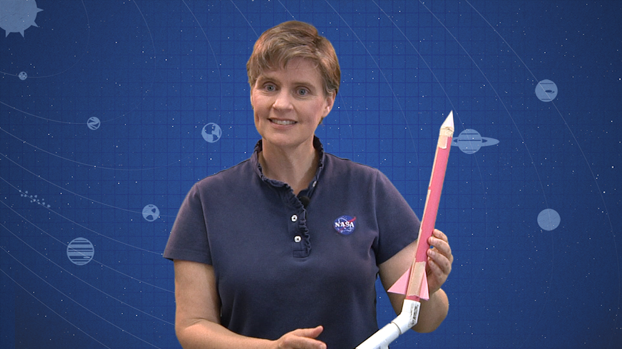
NASA/JPL Edu Lesson: Stomp Rockets Stomp Rockets (Grades 4-9) - In this video lesson, students learn to design, build and launch paper rockets, calculate how high they fly and improve their designs.
Read more


JPL News - Day in Review

DAY IN REVIEW
NASA JPL latest news release
What Uranus Cloud Tops Have in Common With Rotten Eggs

Even after decades of observations and a visit by NASA's Voyager 2 spacecraft, Uranus held on to one critical secret -- the composition of its clouds. Now, one of the key components of the planet's clouds has finally been verified.

A global research team that includes Glenn Orton of NASA's Jet Propulsion Laboratory in Pasadena, California, has spectroscopically dissected the infrared light from Uranus captured by the 26.25-foot (8-meter) Gemini North telescope on Hawaii's Mauna Kea. They found hydrogen sulfide, the odiferous gas that most people avoid, in Uranus' cloud tops. The long-sought evidence was published in the April 23rd issue of the journal Nature Astronomy.

The detection of hydrogen sulfide high in Uranus' cloud deck (and presumably Neptune's) is a striking difference from the gas giant planets located closer to the Sun -- Jupiter and Saturn -- where ammonia is observed above the clouds, but no hydrogen sulfide. These differences in atmospheric composition shed light on questions about the planets' formation and history.

"We've strongly suspected that hydrogen sulfide gas was influencing the millimeter and radio spectrum of Uranus for some time, but we were unable to attribute the absorption needed to identify it positively. Now, that part of the puzzle is falling into place as well," Orton said.

The Gemini data, obtained with the Near-Infrared Integral Field Spectrometer (NIFS), sampled reflected sunlight from a region immediately above the main visible cloud layer in Uranus' atmosphere.

"While the lines we were trying to detect were just barely there, we were able to detect them unambiguously thanks to the sensitivity of NIFS on Gemini, combined with the exquisite conditions on Mauna Kea," said lead author Patrick Irwin of the University of Oxford, U.K.

No worries, though, that the odor of hydrogen sulfide would overtake human senses. According to Irwin, "Suffocation and exposure in the negative 200 degrees Celsius [392 degrees Fahrenheit] atmosphere made of mostly hydrogen, helium and methane would take its toll long before the smell."

Read more on the news of Uranus' atmosphere from Gemini Observatory here.

Caltech in Pasadena, California, manages JPL for NASA.


Friday, April 20, 2018

JPL News - Day in Review

DAY IN REVIEW
NASA JPL latest news release
Four Years of NASA NEOWISE Data

NASA's Near-Earth Object Wide-field Infrared Survey Explorer (NEOWISE) mission has released its fourth year of survey data. Since the mission was restarted in December 2013, after a period of hibernation, the asteroid- and comet-hunter has completely scanned the skies nearly eight times and has observed and characterized 29,375 objects in four years of operations. This total includes 788 near-Earth objects and 136 comets since the mission restart.

Near-Earth objects (NEOs) are comets and asteroids that have been nudged by the gravitational attraction of the planets in our solar system into orbits that allow them to enter Earth's neighborhood. Ten of the objects discovered by NEOWISE in the past year have been classified as potentially hazardous asteroids (PHAs). Near-Earth objects are classified as PHAs, based on their size and how closely they can approach Earth's orbit.

"NEOWISE continues to expand our catalog and knowledge of these elusive and important objects," said Amy Mainzer, NEOWISE principal investigator from NASA's Jet Propulsion Laboratory in Pasadena, California. "In total, NEOWISE has now characterized sizes and reflectivities of over 1,300 near-Earth objects since the spacecraft was launched, offering an invaluable resource for understanding the physical properties of this population, and studying what they are made of and where they have come from."

The NEOWISE team has released an animation depicting detections made by the telescope over its four years of surveying the solar system.

More than 2.5 million infrared images of the sky were collected in the fourth year of operations by NEOWISE. These data are combined with the year one through three NEOWISE data into a single publicly available archive. That archive contains approximately 10.3 million sets of images and a database of more than 76 billion source detections extracted from those images.

Originally called the Wide-field Infrared Survey Explorer (WISE), the spacecraft launched in December 2009. It was placed in hibernation in 2011 after its primary astrophysics mission was completed. In September 2013, it was reactivated, renamed NEOWISE and assigned a new mission: to assist NASA's efforts to identify and characterize the population of near-Earth objects. NEOWISE also is characterizing more distant populations of asteroids and comets to provide information about their sizes and compositions.

NASA's Jet Propulsion Laboratory in Pasadena, California, manages and operates the NEOWISE mission for NASA's Planetary Defense Coordination Office within the Science Mission Directorate in Washington. The Space Dynamics Laboratory in Logan, Utah, built the science instrument. Ball Aerospace & Technologies Corp. of Boulder, Colorado, built the spacecraft. Science data processing takes place at the Infrared Processing and Analysis Center at Caltech in Pasadena. Caltech manages JPL for NASA.

To review the latest data release from NEOWISE, please visit:

http://wise2.ipac.caltech.edu/docs/release/neowise/

For more information about NEOWISE, visit:

https://www.nasa.gov/neowise

http://neowise.ipac.caltech.edu/

More information about asteroids and near-Earth objects is at:

https://www.jpl.nasa.gov/asteroidwatch

To learn more about NASA's efforts for Planetary Defense see:

https://www.nasa.gov/planetarydefense/overview


Thursday, April 19, 2018

JPL News - Day in Review

LATEST NEWS
NASA JPL latest news release
NASA Engineers Dream Big with Small Spacecraft

Many of NASA's most iconic spacecraft towered over the engineers who built them: think Voyagers 1 and 2, Cassini or Galileo -- all large machines that could measure up to a school bus.

But in the past two decades, mini-satellites called CubeSats have made space accessible to a new generation. These briefcase-sized boxes are more focused in their abilities and have a fraction of the mass -- and cost -- of some past titans of space.

In May, engineers will be watching closely as NASA launches its first pair of CubeSats designed for deep space. The twin spacecraft are called Mars Cube One, or MarCO, and were built at NASA's Jet Propulsion Laboratory in Pasadena, California.

Both MarCO spacecraft will be hitching a ride on the same rocket launching InSight, NASA's next robotic lander headed for Mars. The MarCOs are intended to follow InSight on its cruise through space; if they survive the journey, each is equipped with a folding high-gain antenna to relay data about InSight as it enters the Martian atmosphere and lands.

The MarCOs won't produce any science of their own, and aren't required for InSight to send its data back home (the lander will rely on NASA's Mars orbiters for that, in addition to communicating directly with antennas on Earth). But the twins will be a crucial first test of CubeSat technology beyond Earth orbit, demonstrating how they could be used to further explore the solar system.

"These are our scouts," said Andy Klesh of JPL, MarCO's chief engineer. "CubeSats haven't had to survive the intense radiation of a trip to deep space before, or use propulsion to point their way towards Mars. We hope to blaze that trail."

The official names of these two scouts are "MarCO-A" and "MarCO-B." But to the team that built them, they're "Wall-E" and "Eva" -- nicknames based on Pixar characters. Both MarCOs use a compressed gas commonly found in fire extinguishers to push themselves through space, the same way Wall-E did in his 2008 film.

Survival is far from guaranteed. As the saying goes: space is hard. The first challenge will be switching on. The MarCO batteries were last checked in March by Tyvak Nano-Satellite Systems of Irvine, California, which inserted each CubeSat into a special dispenser that will propel it into space. Those batteries will be used to deploy each CubeSat's solar arrays, with the hope that enough power will be left over to turn on their radios. If power is too low, the MarCO team may hear silence until each spacecraft is more fully charged.

If both MarCOs make the journey, they'll test a method of communications relay that could act as a "black box" for future Mars landings, helping engineers understand the difficult process of getting spacecraft to safely touch down on the Red Planet. Mars landings are notoriously hard to stick.

The MarCOs could also prove that CubeSats are ready to go beyond Earth. CubeSats were first developed to teach university students about satellites. Today, they're a major commercial technology, providing data on everything from shipping routes to environmental changes.

NASA scientists are eager to explore the solar system using CubeSats. JPL even has its own CubeSat clean room, where several flight projects have been built, including the MarCOs. For young engineers, the thrill is building something that could potentially reach Mars in just a matter of years rather than a decade.

"We're a small team, so everyone gets experience working on multiple parts of the spacecraft," Klesh said. "You learn everything about building, testing and flying along the way. We're inventing every day at this point."

The MarCOs were built by JPL, which manages InSight and MarCO for NASA. They were funded by both JPL and NASA's Science Mission Directorate. A number of commercial suppliers provided unique technologies for the MarCOs. A full list, along with more information about the spacecraft, can be found here.