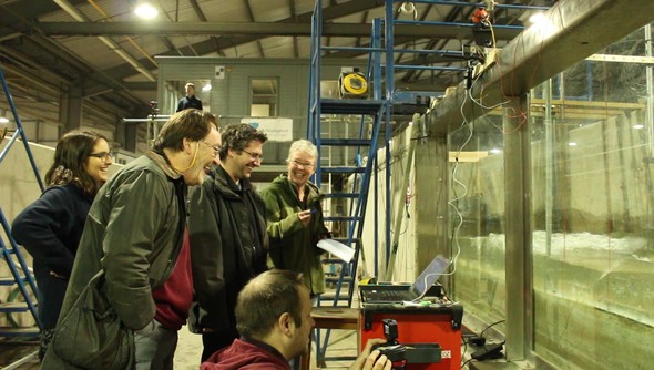
 It was all smiles with the WireWall team this week as the project got underway with a successful day in the HR Wallingford flume tank as they began development of the prototype wave overtopping observation system. This was followed by a session in the classroom as NOC researchers took a crash course in EurOtop to estimate possible conditions that the WireWall system will have to cope with out in the field. The project aims to take capacitance wires - a low-cost instrument that has previously been used to measure waves in the open ocean - and convert it into a system ("WireWall") that will measure coastal overtopping to enable scientists and engineers to plan future coastal defences. Find out more at the WireWall website. 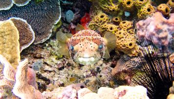 | | Water polluted by the Sanchi oil tanker may reach coral reefs in the Ryukyu Island chain, according to the latest ocean model simulation by scientists from NOC and the University of Southampton, using the leading edge, high-resolution global ocean circulation model, NEMO. To find out more read the story on our website by clicking here. |
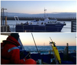 It's been a busy week for the Altereco project, with the successful recovery of equipment from the North Sea and deployment of the next swarm of ocean robots. The first mission saw UEA's Seaglider 'Fin' complete 82 days at sea, achieving 2823 dives, including 80 NOC nitrate sensor profiles. Altereco is a global collaborative project that is demonstrating how autonomous marine technology can be used to monitor the marine ecosystem. The project will help UK scientists and international partners to better define the parameters that we need to measure and understand to assess shelf-sea-wide ecosystem health and to help define good environmental status (GES). Find out more at the Altereco website and get all the latest updates from the team on Twitter. |
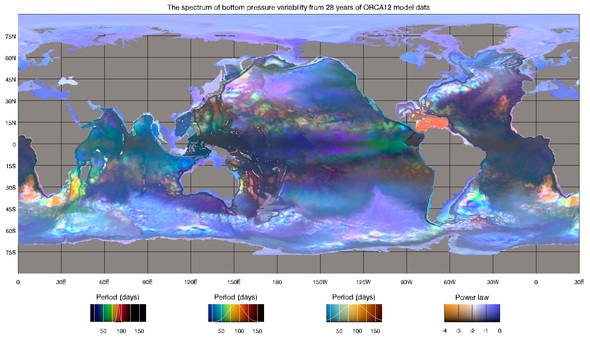 This week scientists at the NOC and the University of Liverpool published a map of pressure spectra at the bottom of the ocean. Bottom pressure is an important way of measuring sea-level change due to the increase in water mass alone, as opposed to the expansion of the ocean due to heat. Bottom pressure is measured at a few hundred locations around the world, but for a detailed map an ocean model is needed. These spectral maps are a way of condensing information about all the frequencies of a time-series at each location onto a map, by translating the frequencies to visible colours. NOC scientist Dr Jo Williams explained how the map works: "So a location with high frequency change is shown in purple, low frequency change in red, bright colours mean a lot of variability and dark colours mean it's very quiet. It's a bit like the false-colour images you see in astronomy." To download a copy of the paper click here. NOC researchers pioneer observations of hurricane wind speeds from space with GPS Researchers at the NOC have developed a technique that, for the first time, uses reflected GPS signals from satellites to measure very high wind speeds and changes in near-surface ocean conditions during hurricanes. This pioneering research, recently published in the leading science journal Geophysical Research Letters, has the potential to improve our understanding of these destructive weather phenomena, offering a potential to improve public safety as well as delivering tangible economic benefits. The research by Giuseppe Foti, Dr Christine Gommenginger and Prof Meric Srokosz of the NOC demonstrates that useful observations of hurricanes can be obtained from spaceborne Global Navigation Satellite Systems-Reflectometry (GNSS-R) data, using satellites that also support the Global Positioning System (GPS) network. The reflections of navigation signals from the Earth's surface can be used to assess hurricane structure and wind speed; previous studies have used this technique to obtain hurricane wind speed data from aircraft, but this new research shows that the same technique also works from Earth orbiting satellites. The full research paper is available at http://onlinelibrary.wiley.com/doi/10.1002/2017GL076166/full Innovation Centre welcomes Deep6 as Strategic Partner  Visionary hybrid marine drone developer, Deep6, has joined the NOC's Marine Robotics Innovation Centre as a Strategic Partner. This brings the total number of companies currently working in partnership with the Innovation Centre to 26. The company is headed up by New Zealand-born CEO Kohen Judd, a graduate of the Royal College of Art who has long been interested in exploration, ecology and evolution. CTO James McVay, also New Zealand-born, is a skilled mechatronics engineer who has worked with global clients to develop custom electronic solutions for a wide of range of pioneering projects. Deep6 is currently developing an Autonomous Surface Vehicle that deploys and recovers a tethered underwater 'drone' which is capable of autonomously gathering a wide range of sensor and video data at depth. |
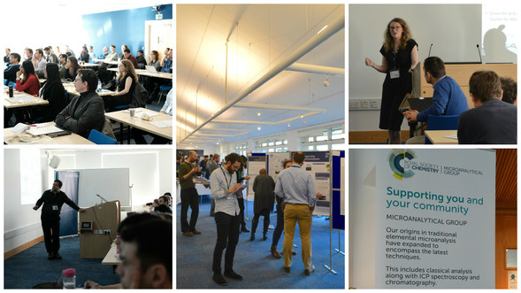 There was another first for the NOC last week as the Centre hosted the UK's first Microfluidics for Analytical Chemistry conference in partnership with the Royal Society of Chemistry. The conference brought together UK researchers developing and applying microfluidic systems for chemical and biochemical analysis. Delegates heard from leading speakers and discussed recent developments in the field as part of an overall aim to nurture and promote the UK microfluidic and analytical communities. The event also saw PhD students and early career researchers present their work in a lively poster session. 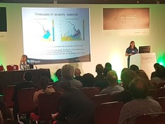 | | This week Dr Lucy Bricheno presented her work modelling the Ganges Delta to better understand the impact of climate change on water levels and salinity. This work used the ARCHER super-computing service and involved examining the process of developing an integrated model that could take in account human factors alongside those of the physical environment. Lucy's talk illustrated the benefits of this simulation to researchers examining the future of level, salinity and make up of river channels in the delta.
|
 | 


No comments:
Post a Comment